


igneous structures
 Igneous rocks comprise 95% of the crust and resulted from the cooling ± crystallization of rock that melted when Earth's radioactivity heated rocks buried deep within the Earth. Intrusive, plutonic rocks comprise the majority of igneous rocks, while extrusive, volcanic rocks are more accessible rocks that initially cooled at the surface. Volcanoes and earthquakes occur at tectonic subduction zones around the "Ring of Fire" or sit above mantle plumes.
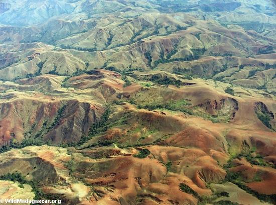
Magma is molten rock formed and cooled at depth. Under the pressure of overburden, magma can rise toward the surface through cracks in the overlying rock strata. However, magma may never reach the surface, and if magma cools and solidifies in rock cracks within these strata, then it forms dikes, sills, diapirs, laccoliths, or huge solidified magma chambers called batholiths, any of which may later become exposed at the surface by erosion. Classification as a dike, sill, igneous diapir, laccolith (2, 3, 4, 5, laccolith (l) and set of sills (r), Mt Hillers), bysmalith, or batholith (1, 2, 3, 4, 5, 6, 7) depends upon orientation of the igneous intrusion within the country rock (cold, intruded rock) and size of the intrusion (diagram, diagram 2).
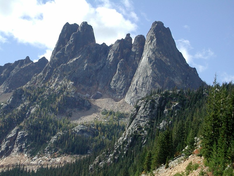
Dikes are tabular or sheet-like bodies of magma that cut vertically or almost vertically through and across strata (discordant plutonic bodies). Hundreds of dikes can invade the cone and inner core of a volcano. If the dike cooled very slowly at great depth, the large crystals of pegmatite dikes have time to form. Sills are tabular slabs or concordant intrusive sheets of igneous rock that have intruded horizontally or nearly horizontally. Laccoliths are moderately large concordant intrusions that cause uplift and folding of the preexisting rocks above the intrusion. Bysmoliths are more or less vertical and cylindrical bodies that crosscut (discordant) adjacent sediments. Batholiths are complex intrusive bodies, that are typically so large that their bases are rarely exposed. The exposed surface area is more than 100 square kilometers. Sometimes batholiths comprise several smaller intrusions. Batholith are usually of granitic composition with minor intermediate varieties. Stocks are smaller structures (less than 100 sq.m) that have probably been fed by deeper level batholiths. Stocks may have been feeders for volcanic eruptions, but because considerable erosion is necessary to expose a stock or batholith, the associated volcanic rocks rarely remain. Xenolithic phenomena produce fragments of metamorphically altered country rock (xenolith) that fell into the melt and became enveloped by the intruding magmatic rock. Xenoliths can be quite large and xenoliths can occur in clusters within the plutonic rock or demonstrate dikelet intrusions by the magma. (excellent, though large bandwidth, illustrations of a xenolith in the Halifax Pluton.)
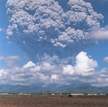
When melted rock flows at the surface it is called lava – Hawaii's and Iceland's basalt lavas fountain or flow freely, while other lavas are sticky and explosive, producing deadly pyroclastic flows (Mount St. Helens, Vesuvius, Pinatubo). See volcanism or volcanoes for more detail.
Large igneous provinces (LIPs) are igneous extrusive structures created by flood basalt vulcanism that emplaced at least 1 million cubic kilometers of lava over periods of a million years. In the distant past, these flows of basalt lava were much more extensive than current flows and not only formed extensive geological provinces, but have been implicated in extinction events. Flood Basalts and Stratigraphic Boundaries
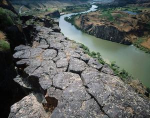
Geologists debate the postulated origin of LIPs as resulting from newly formed mantle plumes or from continental rifts, though it is possible that both mechanisms have operated. Well known flood basalts include the Columbia River Basalts formed a mere 16 million years ago and are now exposed in the Snake River Gorge in Idaho, the Siberian Flood Basalts that are believed responsible for the Earth's greatest extinction event 249 ± 1 years ago at the Permian-Triassic boundary, and the Deccan Flood Basalts in India, which formed 66 million years ago, give or take a million.)
Interestingly, the Deccan Flood Basalts were formed at roughly the time of the dinosaur extinction at the boundary between the Cretaceous and Tertiary, though this extinction is widely believed (by scientists not creationists!) to have resulted from the Chicxulub meteor impact.
◙ subduction zone magmas ◙
Labels: batholiths, dikes, flood basalts, laccoliths, lava, LIPs, magma, sills, stocks